I started this series, but came to a dead end so I changed the name of the post and will start over.
I'm thinking about using Map to do assist in drainage hydrology. In the next posts I'm going to layout what I am thinking how it will work. In this first post I'm going to import data available from the Los Angeles County Public Works into Civil 3D.
The first step is to download and unzip the data. The County provides the information from their Publications Page. Other agencies also provide this type of GIS data. Once you have the data, you'll need to bring it into Civil 3D. In this instance we will use the FDO functionality of Map. To do this open the Map Task Pane (mapwspace).
Go to the Display Manager and press the Data button and choose Connect to Data option.

The Data Connect Palettef will show up. Go to the Add SHP Connection on the left hand side of the Palette. Provide a Connection Name and the source file. For this example I'm going to call it SoilData. Press the connect button and the information will be connected.

Now you can go to the item connected and choose the schema listed and the information will be added to the Map as layers and displayed in model space.

Do the same for the other type of information required for a drainage study. In this case the Los Angeles County provides information for Soils, Land Use (including the appropriate impervious area) and Rain Depth. Save the drawing to save the map, so the next time you open the file you don't have to reconnect the shp files.
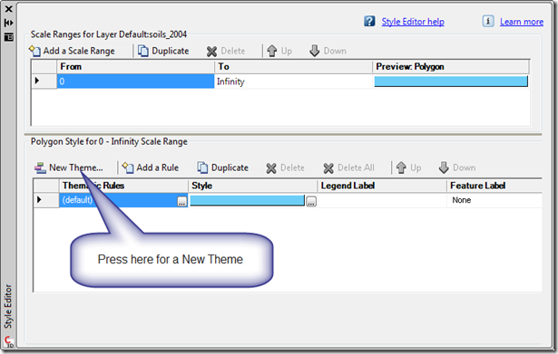
When you look at the data it will probably be one uniform color. Such as the one below. To change it select the layer you want to change. In this case I'm going to change the soils layer. Press the Style button and the Style Editor will show up.

The Style Editor will pop up and here you can create a new theme for the soils. To do this select the New Theme button.
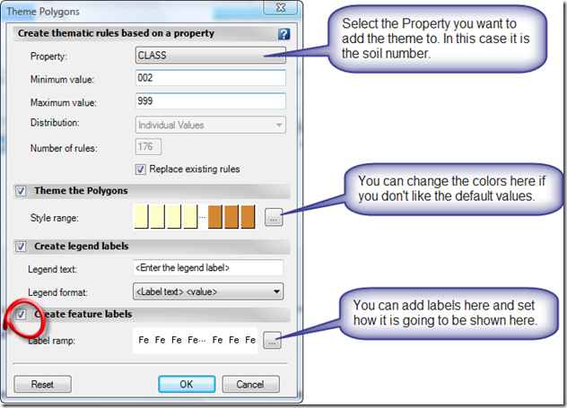
On the next screen you can select the colors the areas will be and a label.
You will then get a better view of the data, which would be helpful as you zoom into your project area. The labels adjust like they do with Civil 3D objects.


1 comment:
Nice post, however the last line is a little misleading. The labels are dynamic like in Civil 3D however the labels in Map 3D misbehave a lot more then labels in Civil 3D. :)
Post a Comment